
Luzerne ZIP Code Geography
The complete geographic list for Luzerne is the 2020 Census ZCTA intersection with the county, plus the practical courthouse postal code. A ZCTA approximates postal ZIP geography. It is not a USPS delivery boundary, and it can handle PO-box-only or unique ZIPs differently. The table therefore preserves the county-intersecting geography without inventing a post-office map or suggesting that an entire listed ZCTA lies inside the county.
| ZIP/ZCTA | Areas covered | Post office | Notes |
|---|---|---|---|
| 17814 | Luzerne County-intersecting Census ZCTA area | Verify USPS Cities by ZIP | Geographic ZCTA only. |
| 17815 | Luzerne County-intersecting Census ZCTA area | Verify USPS Cities by ZIP | Geographic ZCTA only. |
| 17878 | Luzerne County-intersecting Census ZCTA area | Verify USPS Cities by ZIP | Geographic ZCTA only. |
| 18201 | Luzerne County-intersecting Census ZCTA area | Verify USPS Cities by ZIP | County sources use Hazleton, PA 18201. |
| 18202 | Luzerne County-intersecting Census ZCTA area | Verify USPS Cities by ZIP | Geographic ZCTA only. |
| 18210 | Luzerne County-intersecting Census ZCTA area | Verify USPS Cities by ZIP | Geographic ZCTA only. |
| 18216 | Luzerne County-intersecting Census ZCTA area | Verify USPS Cities by ZIP | Geographic ZCTA only. |
| 18219 | Luzerne County-intersecting Census ZCTA area | Verify USPS Cities by ZIP | Geographic ZCTA only. |
| 18221 | Luzerne County-intersecting Census ZCTA area | Verify USPS Cities by ZIP | Geographic ZCTA only. |
| 18222 | Luzerne County-intersecting Census ZCTA area | Verify USPS Cities by ZIP | Geographic ZCTA only. |
| 18223 | Luzerne County-intersecting Census ZCTA area | Verify USPS Cities by ZIP | Geographic ZCTA only. |
| 18224 | Luzerne County-intersecting Census ZCTA area | Verify USPS Cities by ZIP | Geographic ZCTA only. |
| 18225 | Luzerne County-intersecting Census ZCTA area | Verify USPS Cities by ZIP | Geographic ZCTA only. |
| 18234 | Luzerne County-intersecting Census ZCTA area | Verify USPS Cities by ZIP | Geographic ZCTA only. |
| 18237 | Luzerne County-intersecting Census ZCTA area | Verify USPS Cities by ZIP | Geographic ZCTA only. |
| 18239 | Luzerne County-intersecting Census ZCTA area | Verify USPS Cities by ZIP | Geographic ZCTA only. |
| 18241 | Luzerne County-intersecting Census ZCTA area | Verify USPS Cities by ZIP | Geographic ZCTA only. |
| 18246 | Luzerne County-intersecting Census ZCTA area | Verify USPS Cities by ZIP | Geographic ZCTA only. |
| 18249 | Luzerne County-intersecting Census ZCTA area | Verify USPS Cities by ZIP | Geographic ZCTA only. |
| 18254 | Luzerne County-intersecting Census ZCTA area | Verify USPS Cities by ZIP | Geographic ZCTA only. |
| 18255 | Luzerne County-intersecting Census ZCTA area | Verify USPS Cities by ZIP | Geographic ZCTA only. |
| 18256 | Luzerne County-intersecting Census ZCTA area | Verify USPS Cities by ZIP | Geographic ZCTA only. |
| 18347 | Luzerne County-intersecting Census ZCTA area | Verify USPS Cities by ZIP | Geographic ZCTA only. |
| 18411 | Luzerne County-intersecting Census ZCTA area | Verify USPS Cities by ZIP | Geographic ZCTA only. |
| 18424 | Luzerne County-intersecting Census ZCTA area | Verify USPS Cities by ZIP | Geographic ZCTA only. |
| 18444 | Luzerne County-intersecting Census ZCTA area | Verify USPS Cities by ZIP | Geographic ZCTA only. |
| 18507 | Luzerne County-intersecting Census ZCTA area | Verify USPS Cities by ZIP | Geographic ZCTA only. |
| 18518 | Luzerne County-intersecting Census ZCTA area | Verify USPS Cities by ZIP | Geographic ZCTA only. |
| 18602 | Luzerne County-intersecting Census ZCTA area | Verify USPS Cities by ZIP | Geographic ZCTA only. |
| 18603 | Luzerne County-intersecting Census ZCTA area | Verify USPS Cities by ZIP | Geographic ZCTA only. |
| 18610 | Luzerne County-intersecting Census ZCTA area | Verify USPS Cities by ZIP | Geographic ZCTA only. |
| 18612 | Luzerne County-intersecting Census ZCTA area | Verify USPS Cities by ZIP | Geographic ZCTA only. |
| 18614 | Luzerne County-intersecting Census ZCTA area | Verify USPS Cities by ZIP | Geographic ZCTA only. |
| 18615 | Luzerne County-intersecting Census ZCTA area | Verify USPS Cities by ZIP | Geographic ZCTA only. |
| 18617 | Luzerne County-intersecting Census ZCTA area | Verify USPS Cities by ZIP | Geographic ZCTA only. |
| 18618 | Luzerne County-intersecting Census ZCTA area | Verify USPS Cities by ZIP | Geographic ZCTA only. |
| 18621 | Luzerne County-intersecting Census ZCTA area | Verify USPS Cities by ZIP | Geographic ZCTA only. |
| 18622 | Luzerne County-intersecting Census ZCTA area | Verify USPS Cities by ZIP | Geographic ZCTA only. |
| 18627 | Luzerne County-intersecting Census ZCTA area | Verify USPS Cities by ZIP | Geographic ZCTA only. |
| 18634 | Luzerne County-intersecting Census ZCTA area | Verify USPS Cities by ZIP | Geographic ZCTA only. |
| 18635 | Luzerne County-intersecting Census ZCTA area | Verify USPS Cities by ZIP | Geographic ZCTA only. |
| 18636 | Luzerne County-intersecting Census ZCTA area | Verify USPS Cities by ZIP | Geographic ZCTA only. |
| 18640 | Luzerne County-intersecting Census ZCTA area | Verify USPS Cities by ZIP | Geographic ZCTA only. |
| 18641 | Luzerne County-intersecting Census ZCTA area | Verify USPS Cities by ZIP | Geographic ZCTA only. |
| 18642 | Luzerne County-intersecting Census ZCTA area | Verify USPS Cities by ZIP | Geographic ZCTA only. |
| 18643 | Luzerne County-intersecting Census ZCTA area | Verify USPS Cities by ZIP | Geographic ZCTA only. |
| 18644 | Luzerne County-intersecting Census ZCTA area | Verify USPS Cities by ZIP | Geographic ZCTA only. |
| 18651 | Luzerne County-intersecting Census ZCTA area | Verify USPS Cities by ZIP | Geographic ZCTA only. |
| 18655 | Luzerne County-intersecting Census ZCTA area | Verify USPS Cities by ZIP | Geographic ZCTA only. |
| 18656 | Luzerne County-intersecting Census ZCTA area | Verify USPS Cities by ZIP | Geographic ZCTA only. |
| 18660 | Luzerne County-intersecting Census ZCTA area | Verify USPS Cities by ZIP | Geographic ZCTA only. |
| 18661 | Luzerne County-intersecting Census ZCTA area | Verify USPS Cities by ZIP | Geographic ZCTA only. |
| 18701 | Luzerne County-intersecting Census ZCTA area | Verify USPS Cities by ZIP | County sources use Wilkes-Barre, PA 18701. |
| 18702 | Luzerne County-intersecting Census ZCTA area | Verify USPS Cities by ZIP | Geographic ZCTA only. |
| 18704 | Luzerne County-intersecting Census ZCTA area | Verify USPS Cities by ZIP | Geographic ZCTA only. |
| 18705 | Luzerne County-intersecting Census ZCTA area | Verify USPS Cities by ZIP | Geographic ZCTA only. |
| 18706 | Luzerne County-intersecting Census ZCTA area | Verify USPS Cities by ZIP | County 9-1-1/Records Facility addresses use 18706. |
| 18707 | Luzerne County-intersecting Census ZCTA area | Verify USPS Cities by ZIP | County physical/postal example uses Mountain Top, PA 18707. |
| 18708 | Luzerne County-intersecting Census ZCTA area | Verify USPS Cities by ZIP | Geographic ZCTA only. |
| 18709 | Luzerne County-intersecting Census ZCTA area | Verify USPS Cities by ZIP | Geographic ZCTA only. |
| 18711 | County courthouse/annex postal code; non-ZCTA special coverage | Verify USPS Cities by ZIP | County Recorder/Assessment/GIS addresses use Wilkes-Barre, PA 18711; include as practical postal code even though not in intersection table. |
Every row above is a county-intersecting Census ZCTA except the practical 18711 courthouse/annex postal code. Areas covered mean only the portion of that ZCTA that intersects Luzerne County. Post offices are deliberately left for USPS verification because the county research did not find one authoritative countywide inventory of delivery, unique, and PO-box ZIPs.
The Census ZCTA guidance explains why geographic tabulation areas and postal delivery boundaries are not interchangeable.
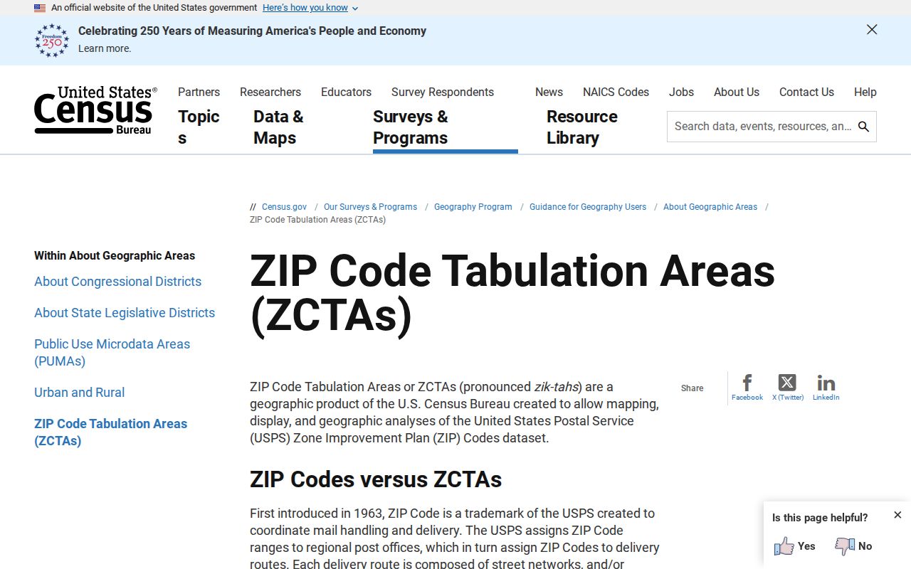
The distinction prevents a geographic table from being misread as a complete USPS delivery list.
Luzerne ZIP Code ZCTA Check
Use the USPS Cities by ZIP lookup to validate the current postal city and ZIP relationship for a specific address. USPS identifies cities served or recognized by a ZIP. It does not confirm a person or organization at an address, and it does not identify the correct county municipality or parcel. That second step belongs to county GIS and the PIN.
For a ZIP code directory search, the right sequence is postal verification first, parcel confirmation second. Census ZCTA geography helps find the broader county area. USPS helps check a postal label. GIS supplies the local map and municipal context. Each tool answers a narrower question than a general map of ZIP outlines.
The USPS Cities by ZIP page is the current postal-city verification route.
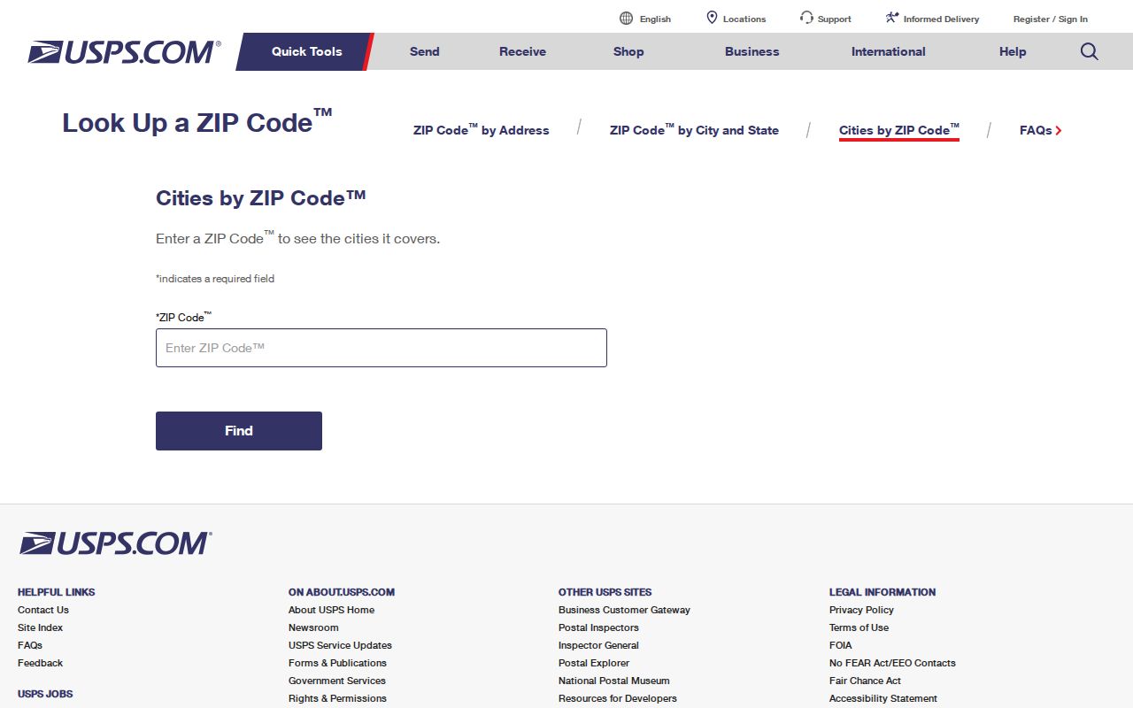
Verify the postal result before using it as an address-search term in a county record system.
Luzerne ZIP Code Search Fields
The county-supplied property-search interface has an optional ZIP field. That makes it a ZIP-filtered owner and property search, not a directory of current residents. The assessment data distinguishes property location from mailing components, and its historical display separately records ZIP and ZIP_FOUR. Use the field with a municipality, owner, property location, or PIN when a broad postal area needs a more precise property question.
| Field or tool | Use in Luzerne research | Result limit |
|---|---|---|
| ZIP | Optional property-search filter. | Finds owner/property data, not a household roster. |
| Property Location | Connects a result to its situs address. | Use a bare street name when searching by address. |
| Municipality | Separates repeated street names. | A postal city name may differ from it. |
| PIN | Connects assessment, GIS, and parcel records. | Use the exact county identifier. |
| UJS Parcel Zip Code | Advanced court/calendar parcel criterion. | Not a way to find residents by ZIP. |
The statewide judiciary portal’s Parcel Zip Code is likewise a court or calendar filter, not a resident-search field. The voter status tool is individual, while the county Street List is a controlled address-based product. Postal filtering is useful only after the record type and its access rules are clear.
Search Luzerne Records by ZIP Code
A ZIP narrows an address question, but the resulting record must still be checked against the right county source. The assessment file can filter property data by ZIP. GIS resolves the actual municipality, parcel, PIN, and structure address. The Recorder uses parties and legal descriptions for ownership history. A voter Street List is defined by election-law request conditions, not by open ZIP browsing.
- Validate the postal city and ZIP for the exact address through USPS.
- Use county GIS to confirm the actual municipality, parcel, PIN, and structure address.
- Use the optional ZIP field in assessment data for an owner or tax-record question, then compare property location with mailing data.
- For recorded ownership, search the Recorder by party, legal description, instrument number, or book and page rather than treating the ZIP as title evidence.
- For a dated household question, select a historical directory or map source for the appropriate year. For a municipal permit or code record, request the existing file from the city, borough, or township that holds it.
Once a postal area has been narrowed to a particular address or road, use the Luzerne street directory for the address-to-parcel, deed, voter, and historical-directory chain.
Note: A ZIP filter is most useful when it is paired with a specific record question, such as property ownership, parcel location, or a permitted address-based voter request.
Luzerne ZIP Code Addressing
County 9-1-1 serves 76 municipalities and assigns physical addresses by named road and one-hundredth-mile measurement under its NENA system. A through road generally starts at its south or west end, with even numbers tending to the left and odd numbers to the right. The county and municipalities collaborate, while municipalities retain the final naming and numbering decision.
The county provides a correction and new-address form for a physical address problem. It asks for name, phone, house number, street name, municipality or “Do Not Know,” location or landmark description, and return email. That route is useful when a rural or postal address does not match the county map. It corrects an address question. It does not create evidence about a person at the location.
The Luzerne 9-1-1 correction form provides the county’s physical-address verification path.
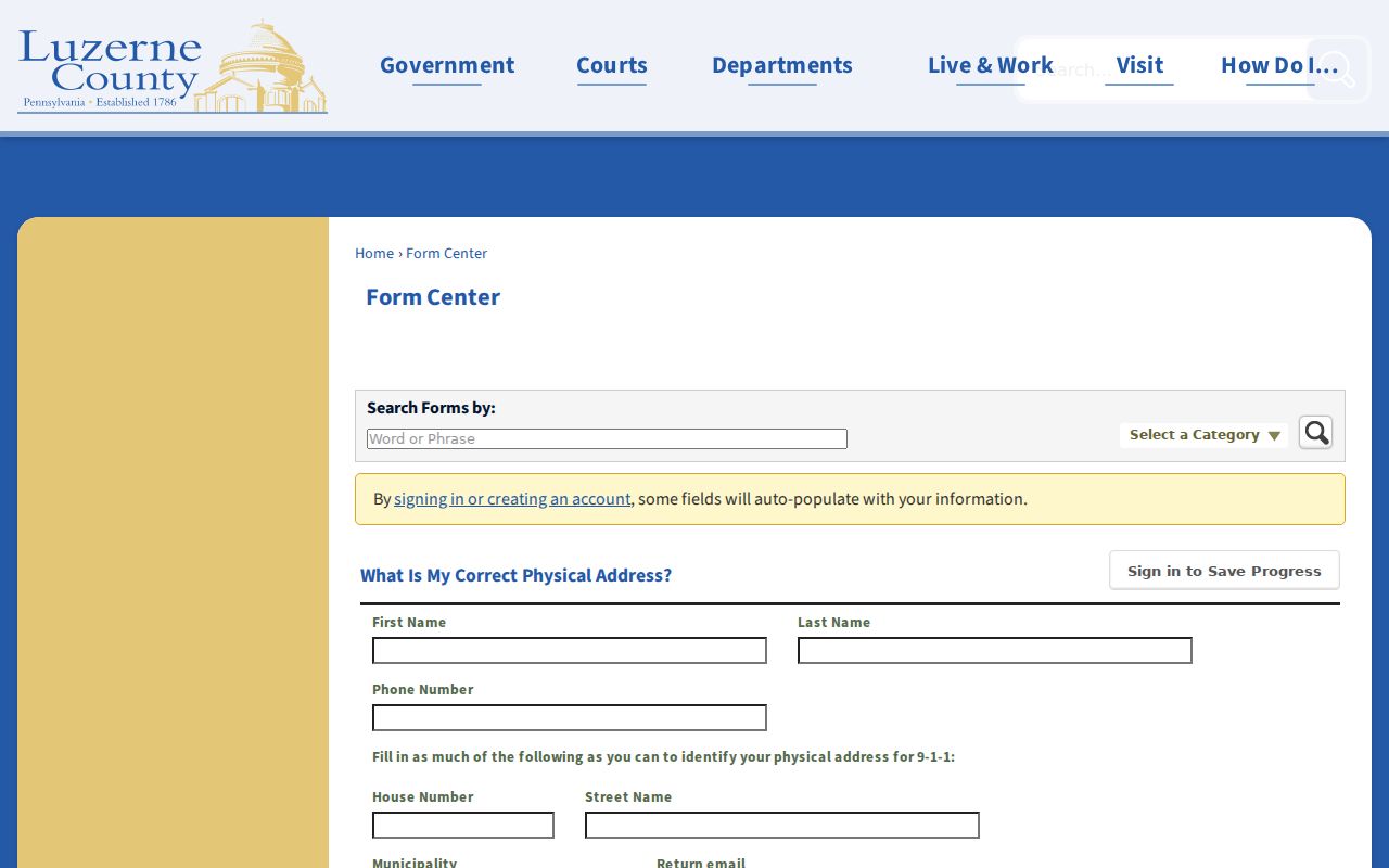
The municipality choice and landmark field make the form a practical fallback when a postal label is unclear.
Luzerne ZIP Code Boundary Myth
A ZIP boundary is not a municipal boundary. Luzerne’s 9-1-1 address information gives a concrete example: physical 67 Lehigh Street in Fairview Township can use the postal line 67 Lehigh St., Mountain Top, PA 18707. Mountain Top can span multiple police and fire agencies. The ZIP and postal-city label therefore cannot decide the municipality, jurisdiction, parcel, or current resident.
Insider tip. Verify the postal city with USPS, then verify the property location, municipality, PIN, and structure address with Luzerne GIS before requesting a local record.
This same distinction explains why the Luzerne ZIP code directory cannot be called a complete delivery, PO-box, or unique-ZIP inventory. The Census table is geographically comprehensive for county-intersecting ZCTAs. USPS remains the source for a particular delivery relationship.
Luzerne ZIP Code Record Limits
ZIP geography supplies a way to organize a search, not a general directory of people. The assessment ZIP field can return property and tax data; the UJS parcel criterion can narrow a court or calendar query; and a voter product has its own statutory request process. None identifies everyone associated with a postal area. Mailing address, property location, and legal description remain separate record fields.
For a document that is not online, the county’s RTKL process may be a route to an existing public record, but it does not override protected information or special election-law restrictions. The county has no documented single portal that turns every delivery ZIP into a municipal, parcel, permit, ownership, and household index. Preserve the address, PIN, source, and date so the relevant custodian can confirm the limited fact at issue.
Luzerne ZIP Code Terms
Postal and county systems use related but different labels. The terms below help keep a geographic lookup from becoming an unsupported claim about delivery, government jurisdiction, or a person’s location. For any real address, compare the USPS result with the county’s parcel and assessment data.
- ZIP and ZIP+4
- A ZIP is a USPS postal code. ZIP+4 adds four digits for a more specific delivery segment; the assessment display can store ZIP and ZIP_FOUR separately.
- PO-box ZIP
- A postal code used for box delivery. Do not assume it maps to residential parcels or a municipal boundary.
- Unique ZIP
- A code associated with one organization. It is not, by itself, a map of public residences.
- Carrier route
- A delivery sequence used by USPS. It is different from a county municipality, parcel boundary, or voting district.
Note: The county geography table is a ZCTA intersection list, so USPS verification remains necessary for a current city, delivery, PO-box, or unique-ZIP question.