
Sources for Luzerne Previous Residents
Different Luzerne records answer different parts of an address history. Assessment data supplies a current parcel and owner-of-record starting point. Recorder indexes supply the dated transfer chain. City directories and census sources can place a named household at an address in a selected period, while maps test the location and structure context. Keep the source, access channel, date, and the specific field copied from each result. That record trail makes it easier to identify a mismatch before it becomes part of the history.
| Source | Years it covers | Where held | What it can show |
|---|---|---|---|
| IQS deed books and indexes | Deeds 1786–1967; indexes through Aug. 1, 1993 | IQS, Recorder, or Records Facility | Historic grantor, grantee, date, book/page, and legal-description trail |
| Landex document environment | 1968–present; images indexed Dec. 1980–present | Landex, Recorder office, or Records Facility | Modern recorded deeds, mortgages, releases, and document references |
| Estate indexes | 1875–2004 | IQS, Register, Records Center, or Landex for mid-1998 forward | Estate number and will indicator behind a possible transfer |
| LCHS city directories | 1871–2004 | Luzerne County Historical Society | Dated head-of-household, spouse, occupation, and address lead |
| LCHS census indexes | 1800–1870 head-of-household indexes | Luzerne County Historical Society | County, city or township, and original-census page pointer |
| Ward, atlas, and Sanborn maps | Selected historic years | LCHS and Library of Congress | Street, lot, ward, and structure context rather than a resident list |
For a recent transfer, start with the assessment card and the Landex-era record. For an older transaction, switch to IQS and the historic index books. For a former occupant rather than a former owner, use a dated directory and census pairing after the parcel chain is stable.
Luzerne Assessment Cards First
The Luzerne property-record-card procedure is a documented official starting point for one address. Preserve the property location, owner, mailing fields, PIN, plate number, grantee field, and assessed values that appear on the card or associated county data. The Property Location field is the situs, meaning the physical site. Mailing fields show where tax correspondence goes and may be different from the site.
County assessment instructions also warn that less input may work better. For an address search, use the street name without the number, street suffix, or periods, because county property designations can differ from a familiar address form. The Assessment Office gives a $1 counter card route. A mailed residential card request is $4 and requires the PIN and a County of Luzerne check; email and fax handling have their own published check procedure.
Cutovers in Luzerne Previous Residents
The county's recorded-property trail has distinct eras. The IQS EFilm/Infodex gateway covers deeds from 1786 through 1967 and historic grantor/grantee indexes through August 1, 1993. Landex handles the 1968 to present environment, with images indexed from December 1980 forward. The overlap in index and document access is useful, but it does not mean one system replaces the other. Retain the citation on both sides of every handoff.
The Landex Webstore provides free index searching for Luzerne, but document downloads require payment. Its search process uses Search, Cart, Checkout, and Account modes; selected records are placed in a cart, paid by credit card, and made available as a PDF in the account order history. Landex states a $5 order-processing charge in addition to document price. Certified copies remain an office-only request.
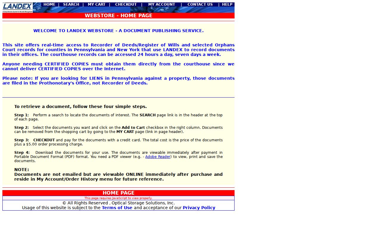
The Webstore image represents the newer document route. When an older citation or an unavailable image interrupts the chain, use the Recorder or Records Facility rather than assuming the chain ended online. Note: Luzerne's record history is an access transition, not evidence that every early document is digitally viewable.
Tracing Luzerne County Deed Transfers
A deed is evidence of a recorded property transaction. It does not identify every former resident. Build the Luzerne deed chain from the present owner and parcel facts, then work backward one recorded transaction at a time. The stable test is the legal description, PIN, plate, lot, or deed reference, not a common surname or a similarly numbered street address. Log the source system used, because the search changes at the county's recorded-era cutovers.
- Preserve the current owner, PIN, property location, and any plate or grantee clue from assessment data.
- Find the acquisition document in the Recorder index and record the grantee, grantor, recording date, instrument number or book/page, and legal or plate description.
- Search the seller named as grantor on that deed as a grantee in an earlier index to locate the seller's acquisition.
- Repeat the sequence backward, testing the legal description, PIN, lot, or plate context at every step.
- Use Landex for 1968 forward and IQS for deeds through 1967; at the 1967/1968 and 1993 index handoffs, carry citations to the Recorder or Records Facility when needed.
- Grantor
- The party transferring an interest in a recorded document.
- Grantee
- The party receiving that interest. In a backward chain, a prior grantor is often searched next as a grantee.
- Chain of title
- A dated sequence of recorded property transfers tied to the same parcel or legal description.
- Legal description
- The lot, block, plate, bounds, or other formal land description that can remain stable when the street form changes.
Luzerne Legal Descriptions Bridge Addresses
Address continuity is a real Luzerne research problem. The county says assessment property designations may not match common street forms, while the GIS accepts a road, municipality, parcel, or address. A recorded document may also lack a complete street address. Preserve the PIN across GIS and assessment results, then use deed book/page, plate, lot, ward, map sheet, and legal description to test whether two records concern the same place.
No authoritative source in the research establishes a countywide Luzerne street-renumbering or renaming event. Do not assign an apparent number change to a countywide renumbering. Instead, compare the selected directory year with a ward map, atlas, Sanborn sheet, deed description, and parcel clue. The county's free GIS shows parcel, owner, value, structure-address, road, district, and aerial context; subscription-only tools add mailing, deed-reference, historical-imagery, and parcel-radius features.
Luzerne Estate Indexes Explain Transfers
An estate index can explain why a name change appears in a deed chain. In IQS, Luzerne estate indexes cover 1875 through 2004. Select the year and first letter of the decedent's surname, then use Find name with last and first name and continue through later pages. The index can provide an estate number and indicate whether there is a will. It is a lead to the underlying permitted file, not a complete account of heirs or property.
The Register of Wills and Clerk of the Orphans' Court explains the office's probate, appointment, inheritance-tax, Orphans' Court, and marriage functions. For a full estate file, the research identifies a call to the Records Center, a Records Center visit, or Landex for estates from mid-1998 forward. Adoption files and some later Orphans' Court material have stated access limits.
The Recorder's recording and document-access page is the source for the county filing route shown here. Its related property-document procedures underscore why an individual tracing a parcel should keep the dated party sequence and formal location clues rather than expect a staff-created title history.
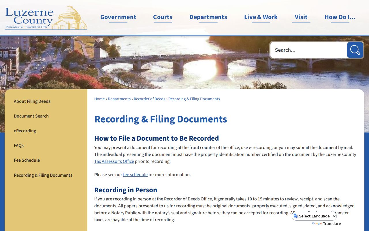
The Recorder image belongs with the recorded-document part of the trail. It does not replace the Register or Records Center when an estate reference needs a separate file request or has a restricted access category.
Directory Evidence for Luzerne Addresses
Recorded owners are only one layer of an address history. The Luzerne County Historical Society's 1871–2004 city-directory run and Osterhout's municipal runs can place a head of household at a selected address and year. A directory can include spouse, occupation, business address, and home address, while some LCHS editions have a street index. Confirm that the chosen volume has a street index before trying an address-first search, because that feature is not documented for every edition.
The historical collections themselves are described with their local access limits on the Luzerne City Directories page. For this address trail, preserve a directory entry exactly as printed, compare the year before and after, and keep it separate from the owner-of-record chain. A missing listing can be an omission, a changed name form, a move, or a later event that needs another dated source.
Address trail: parcel/PIN and legal description → acquisition deed → prior grantor searched as grantee → selected-year directory entry → closest released census → estate, obituary, or public vital evidence for a later event.
Pairing Luzerne Census and Directories
LCHS has a 1790 census book, head-of-household indexes from 1800 through 1870, and census material from 1790 through 1930. The early indexes point to the county, city or township, and the original census page. Osterhout also lists Luzerne census microfilm from 1790 through 1930. Use the directory year to select the nearest released federal census, then record every household-name variant and address clue instead of forcing a precise surname match.
- Choose the directory edition closest to the period in question and copy its name and address fields.
- Use the LCHS head-of-household index when the year falls between 1800 and 1870, then locate the original page.
- Compare municipality, address clues, surname variants, and other named people before treating entries as the same household.
- For the missing 1890 census interval, pair two or more sources such as directories, land or tax records, maps, newspapers, church or cemetery records, and public vital indexes.
A census and directory may disagree because the records were created at different times or because a family changed address. Keep both dates. LCHS notes that newspaper microfilm is unindexed and needs a date, while its Wilkes-Barre Record Almanac has coverage limits that prevent a missing entry from proving survival or absence.
Luzerne Map Checks for Former Addresses
Historic maps are the final location check when a former address does not fit a modern street label. LCHS has the 1873 county atlas, Wilkes-Barre ward maps for 1882, 1894, and 1904, the 1933 Sturdevant Atlas, and early and mid-century Sanborn material for Luzerne communities. The 1891 Wilkes-Barre Sanborn atlas has 56 digitized sheets at the Library of Congress, though the supplied manifest has no matching image asset.
These maps document street and building context, not a list of former residents. Pair a ward, sheet, lot, or structure clue with the date of the directory and recorded deed. No authoritative countywide house-history guide was located, so the documented path is a combination of LCHS and Osterhout local-history resources, Recorder material, maps, and the specific municipality's counter or targeted Right-to-Know request for an existing permit or code file.