
Luzerne Neighbors Source Map
A block search has several narrow sources. The free GIS map locates a parcel and its visible owner-of-record data. An Assessment property card adds county tax and property fields for a selected PIN. Deeds describe recorded property parties and dates. A county Street List is a controlled election record, not an open browse. Historic directories and maps can place a head of household at an address in a particular year. The evidence is strongest when the parcel, PIN, source date, and municipality agree.
| Block Source | What It Shows | Access and Boundary |
|---|---|---|
| Free GIS map browse | Parcel outline, PIN, public owner name, value, street and structure-address context | Free portal or terminal; manually inspect adjoining parcels |
| GIS subscription radius | Selected-distance parcels around a target parcel or point | Subscription only; it is not a free-map feature |
| Assessment property card | Owner, tax and mailing fields, property location, PIN, and parcel attributes | Counter, mail, fax, or email route for selected PINs |
| Recorder deed chain | Recorded property-party relationship, date, and legal description | IQS, Landex, counter, or Records Center; not a household list |
| County Street List | Defined voter information, including address, party, and status | Signed request, ID, certification, and election-code restrictions |
| Historic directory or map | Dated street or head-of-household evidence | Selected year and volume only; not current evidence |
A public owner label proves a county property record, not that every current Luzerne neighbor lives there. A tax mailing address can also differ from the physical property location. Treat non-owner household, delivery, utility, and protected-address data as outside a general block search.
Map Luzerne Neighbors by Parcel
The county’s address-to-record chain is physical address, GIS parcel and PIN, assessment card, deed book or legal description, then a dated historical source where needed. A PIN is the bridge between the map and county property records. It is more reliable than a street label when similarly named roads, postal labels, or property designations create confusion. The free GIS viewer accepts road, municipality, parcel, or address searches, and its Query PIN tool can highlight more than one polygon assigned to one PIN.
- Find the target address in the county GIS portal and confirm the displayed road, municipality, structure address, and PIN.
- Click the immediately adjoining parcel outlines and record each PIN with its visible owner-of-record label and the map date.
- Request or review a property card only for the selected PINs when an official county confirmation is needed.
- Use the legal description, book and page, or instrument reference to test a recorded deed connection for one parcel.
- Switch to the Luzerne street directory when the goal becomes a full named-street record trail rather than the parcels closest to one address.
Do not use a measurement line as a property boundary decision. The county says the portal’s measurement tools are not engineering-grade. For a printed fallback, GIS Services can make an 11 by 17 aerial property map when given an address or PIN.
Free Luzerne GIS Block Browse
The county GIS comparison draws a useful line between the free and subscription viewers. The free portal shows parcel PIN, public owner name, assessed values, improvement data, 2024 aerial imagery, roads, school districts, and structure addresses. It also documents query and measurement tools. That is enough to identify the visible parcels around a block and to establish map context without claiming a built-in neighbor-radius list.
| Free Map Browse | Subscription GIS Tools |
|---|---|
| Manually click adjacent parcel outlines and retain PINs. | Search by Property and Search Notification use a parcel or point buffer. |
| Public owner, value, structure address, roads, and map layers. | Mailing address, deed reference, acreage, historical imagery, zoning, flood, and proximity tools. |
| Free public portal or public GIS terminal. | Subscription route; ask GIS about current price and terms. |
Myth. A map owner label is not a roster of your Luzerne neighbors. It documents a public property interest. The free map supports manual parcel review, while mailing and radius tools are features the county reserves for the subscription viewer.
Luzerne Neighbor Property Cards
When a particular parcel needs a county-confirmed record, request a property card from the Assessment Office rather than relying only on an externally hosted display. The card route is PIN-specific and records county assessment information, such as owner, tax fields, property location, and parcel attributes. The county instructs address searchers to use less input when using assessment data: a bare street name works better than a house number, suffix, or punctuation when the goal is to identify the correct parcel.
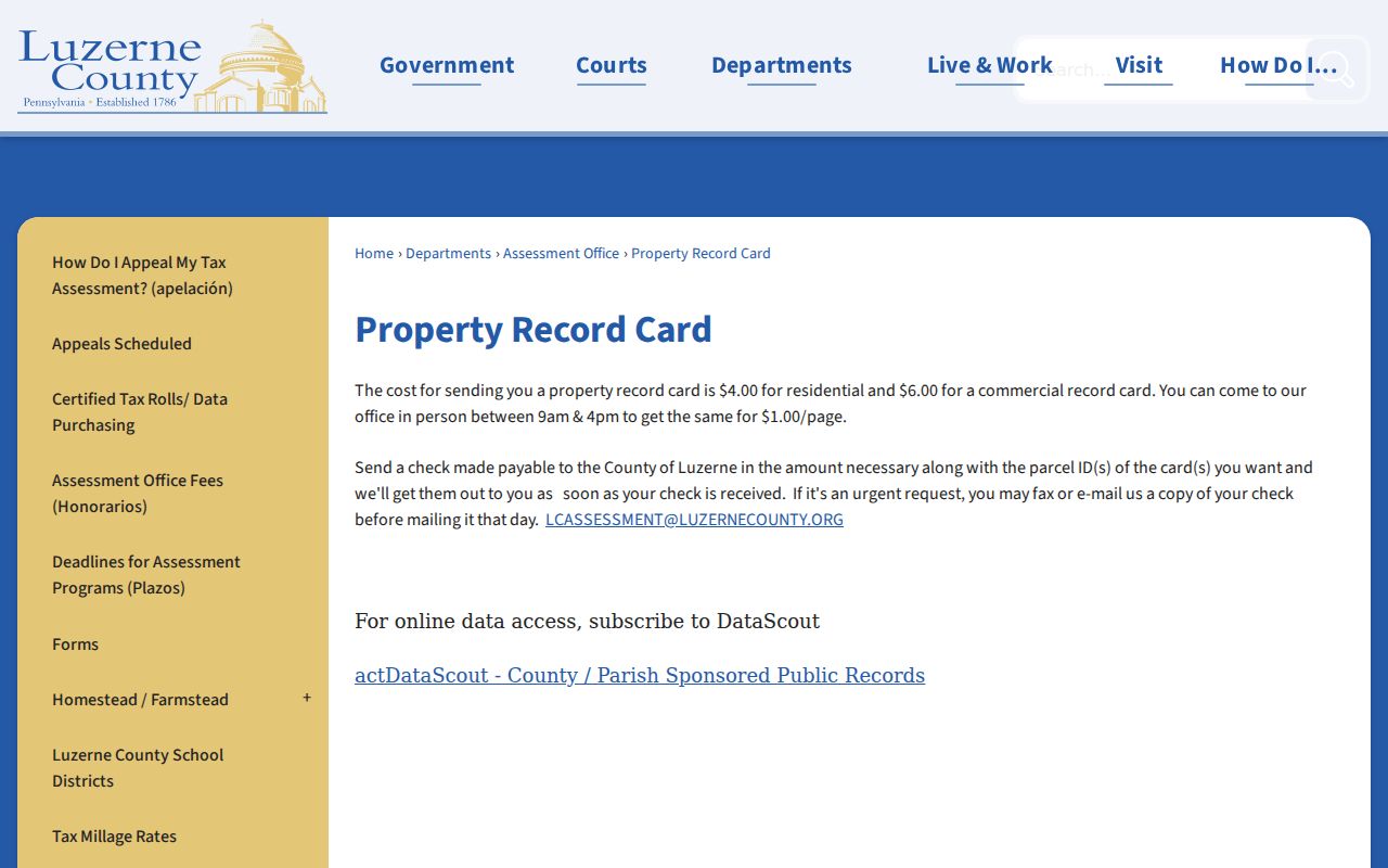
The official Luzerne County property-record-card route is shown below.
Use the selected PIN in the request so the returned card stays tied to the parcel inspected on the map.
The Assessment Office lists counter, mail, fax, and email channels. A counter card is $1; mail requests are $4 for a residential card and $6 for a commercial card. For urgent fax or email handling, the county says to send a copy of the check and mail the original the same day. Those routes verify an assessment record, not present household membership.
Luzerne Block Voter Records
A Street List is the county’s controlled route for block-level voter information. It can contain name, residential address, mailing address, party, and active or inactive status. The county also offers Walking Lists, Public Information Voter Listings, and Voter Exports with different fields and delivery rules. The individual state registration-status route serves a separate personal-status purpose and should not be treated as an open neighbor directory.
To request a Street List, use Luzerne’s voter-file form, select the product, provide requester identification and contact information, sign the statutory affirmation, and provide the candidate and district information where the form requires it. An emailed request needs a copy of identification; in-person submission needs ID presentation. The form bars unrelated use and internet publication. Other electronic reports are generally $20, and printed reports are generally $0.25 per page. Signatures and SURE registration numbers are not public list fields.
Note: Voting history records participation, never ballot selections.
Luzerne Parcel Deed Records
A deed chain can explain a parcel’s recorded ownership history, but it does not establish who currently lives on the block. Use the PIN or legal description from the property record to find the acquisition document. Record the grantee, grantor, date, book and page or instrument number, and legal description. The prior grantor becomes the next grantee search in the earlier index, provided the lot, plate, or legal description stays consistent. Common surnames and similar street numbers are not enough.
Luzerne’s Recorder divides the historical trail between IQS for deeds from 1786 through 1967 and Landex for the later document environment. The historic grantor-grantee indexes extend through August 1, 1993. A recorded instrument may not contain a full street address, and certified copies are office-only. The deed is evidence of a documented property relationship at a point in time, never proof of a complete household.
No Luzerne Countywide Roster
No authoritative countywide HOA, neighborhood-association, block-watch, or membership roster was verified in the Luzerne County research. That absence matters. Do not infer association membership from a parcel, a map label, a street name, or an organization name. A block does not become a directory merely because several public property records sit next to one another.
| Community Layer | Documented Finding |
|---|---|
| Countywide HOA or neighborhood roster | No authoritative public database was located. |
| Block-watch membership | No countywide verified membership list was located. |
| Historic street evidence | Selected directories and maps can place a head of household in a specific year, not establish a current community roster. |
| Local archival support | Luzerne County Historical Society sources can provide dated directory, map, newspaper, and surname research leads. |
For a historical question, preserve the selected volume’s year, address wording, and any street-index limitation. That keeps a past household clue from being presented as a current record about Luzerne neighbors.
Official Block Record Comparison
Official records and commercial neighbor-finding categories answer different questions. The county sources identify what they hold, when the record was created, and how a request is restricted. Commercial categories combine information from varied sources and can be incomplete or dated. They should never override a county custodian’s record or convert a property owner field into a claim about all people at an address.
| Official County or State Record | Commercial Neighbor-Finding Category |
|---|---|
| States the actual record type, keeper, and access rule. | May combine sources with differing dates and methods. |
| Lets a researcher keep a PIN, document number, docket, or request form with the result. | May not show the source record or the date that supports a claimed connection. |
| Preserves statutory restrictions, redactions, and correction channels. | Cannot remove the limits on protected addresses, voter data, or court records. |
Use official property, Recorder, court, and election channels for the narrow fact each holds. If a profile conflicts with a custodian record, follow the custodian and ask that office how to correct its own information.
Luzerne Neighbor Boundaries
Pennsylvania’s Right-to-Know Law does not defeat another confidentiality law, court order, or privilege. Under the election rules, voter-file recipients must identify themselves and sign a statement before obtaining specified public products. Court filings can be sealed or confidential. Driver and vehicle data use a separate state process. The county does not have to create a new compilation when no existing record matches the request.
The Pennsylvania Address Confidentiality Program protects an eligible participant’s actual address through a substitute-address process. It is a safety route, not a lookup method. Utility customer information, delivery information, protected addresses, and non-owner household information are not general public block fields. When an official record needs correction, contact the Assessment Office, Recorder, Election Bureau, court filing office, or state custodian that owns it.
Lawful use. Use Luzerne neighbor records for personal, lawful research and respect every access boundary. Do not use public information to stalk, harass, threaten, or intimidate anyone.